Light Limitation
2022
Background
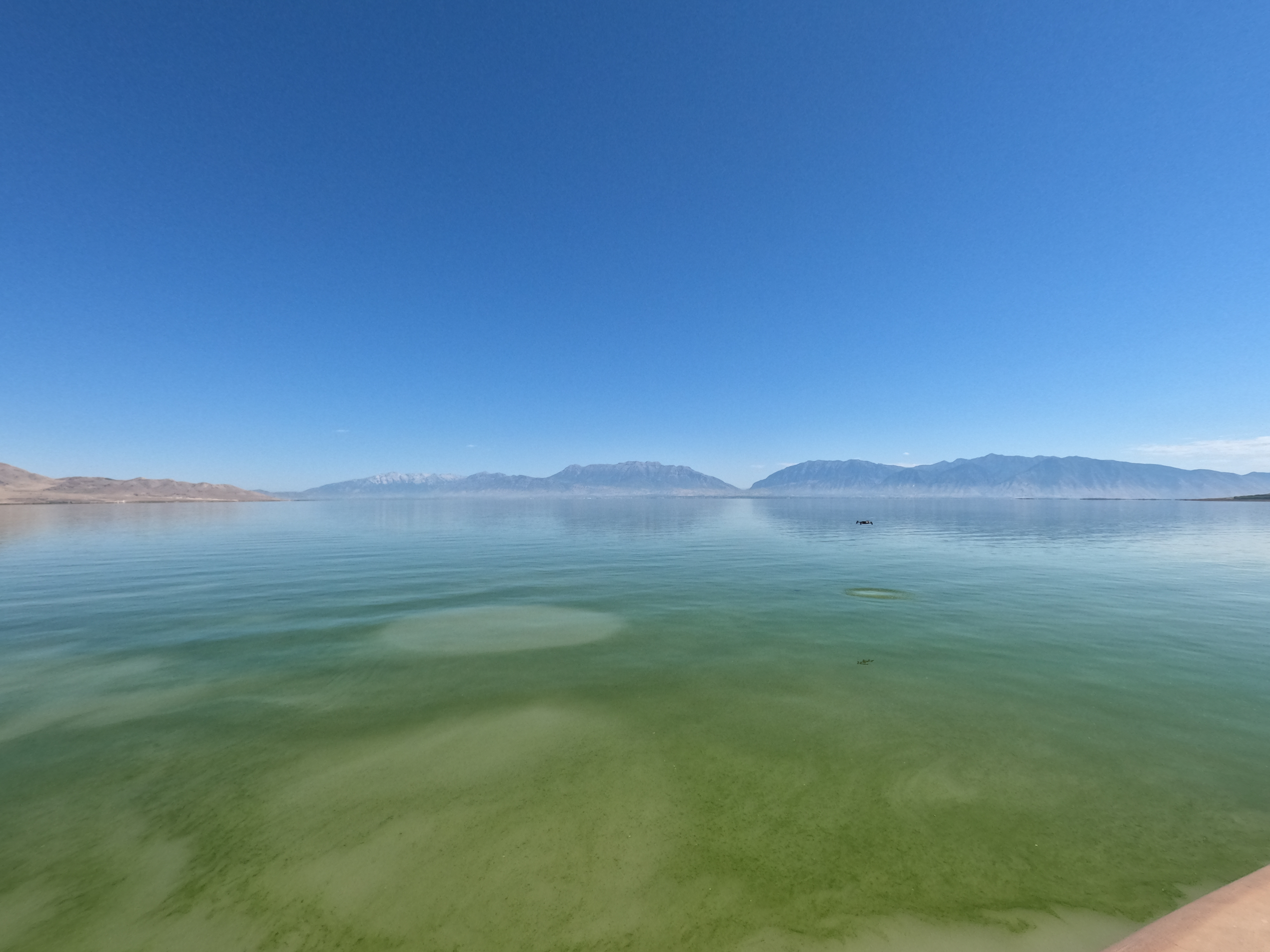
Utah Lake (UL) is the third largest freshwater lake in the western U.S. with a surface area of about 148 mi2 and a watershed approximately 2,950 mi2. It has five major inflows the American Fork River, Provo River, Hobble Creek, Spanish Fork Creek, and Currant Creek and only one outlet, the Jordan River. It is a shallow lake with an average depth of 9 feet and an uncompacted clay sediment. It provides critical habitat to about 10 million fish, 10 million migratory birds, and has 30,000 acres of wetlands. In addition to ecological habitat, UL provides many other benefits including water storage, secondary irrigation, and recreation (e.g. sailing, fishing, bird watching).
UL is well mixed and turbid due to its shallow nature and near constant wind. For reference, the average secchi depth measurements for 25 readings taken throughout the summer of 2023 was 14 cm (5.5 in). The high turbidity of UL limits the light penetration and attenuated light in the water column, limiting the depths at which aquatic vegetation can grow.
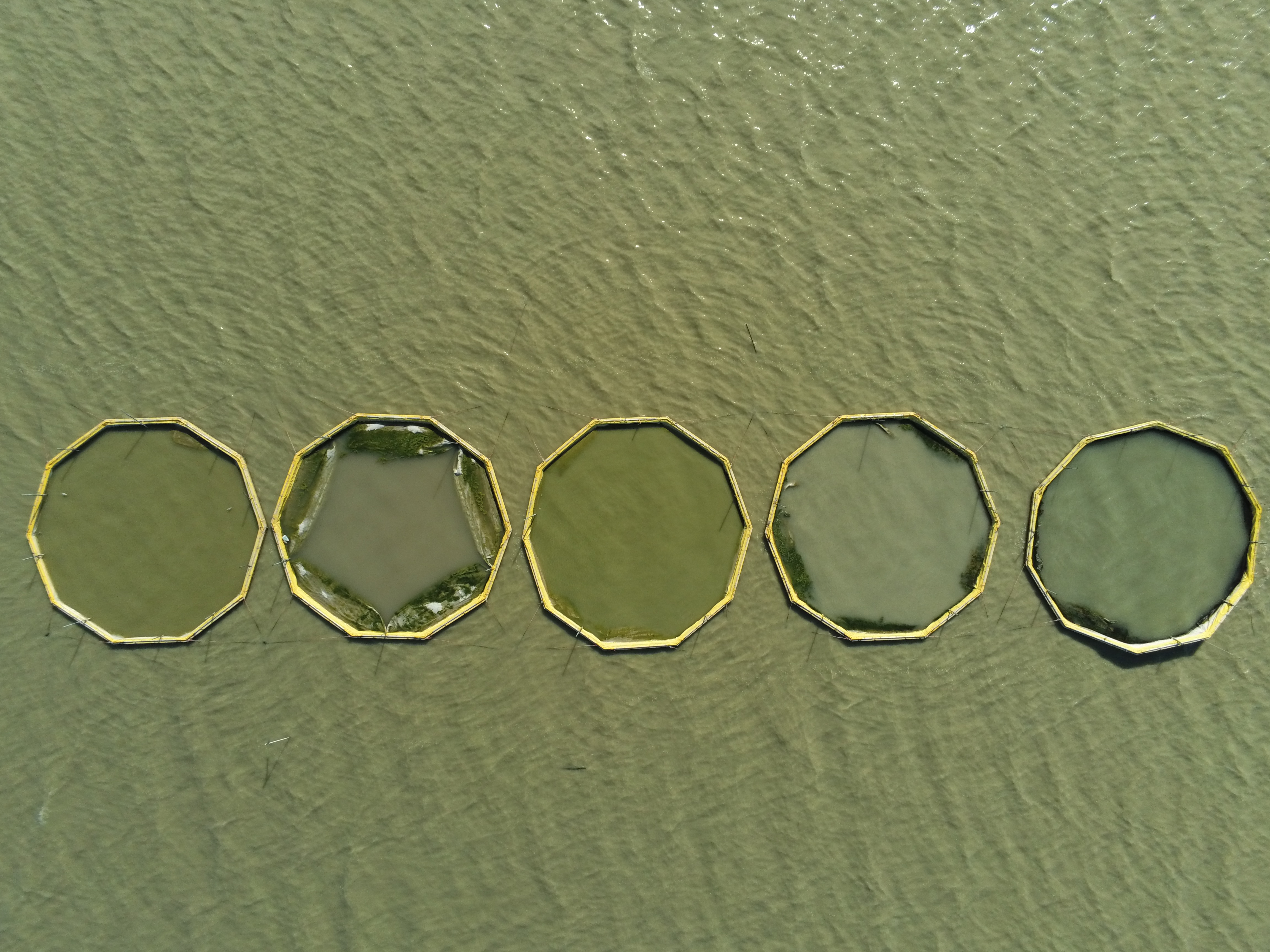
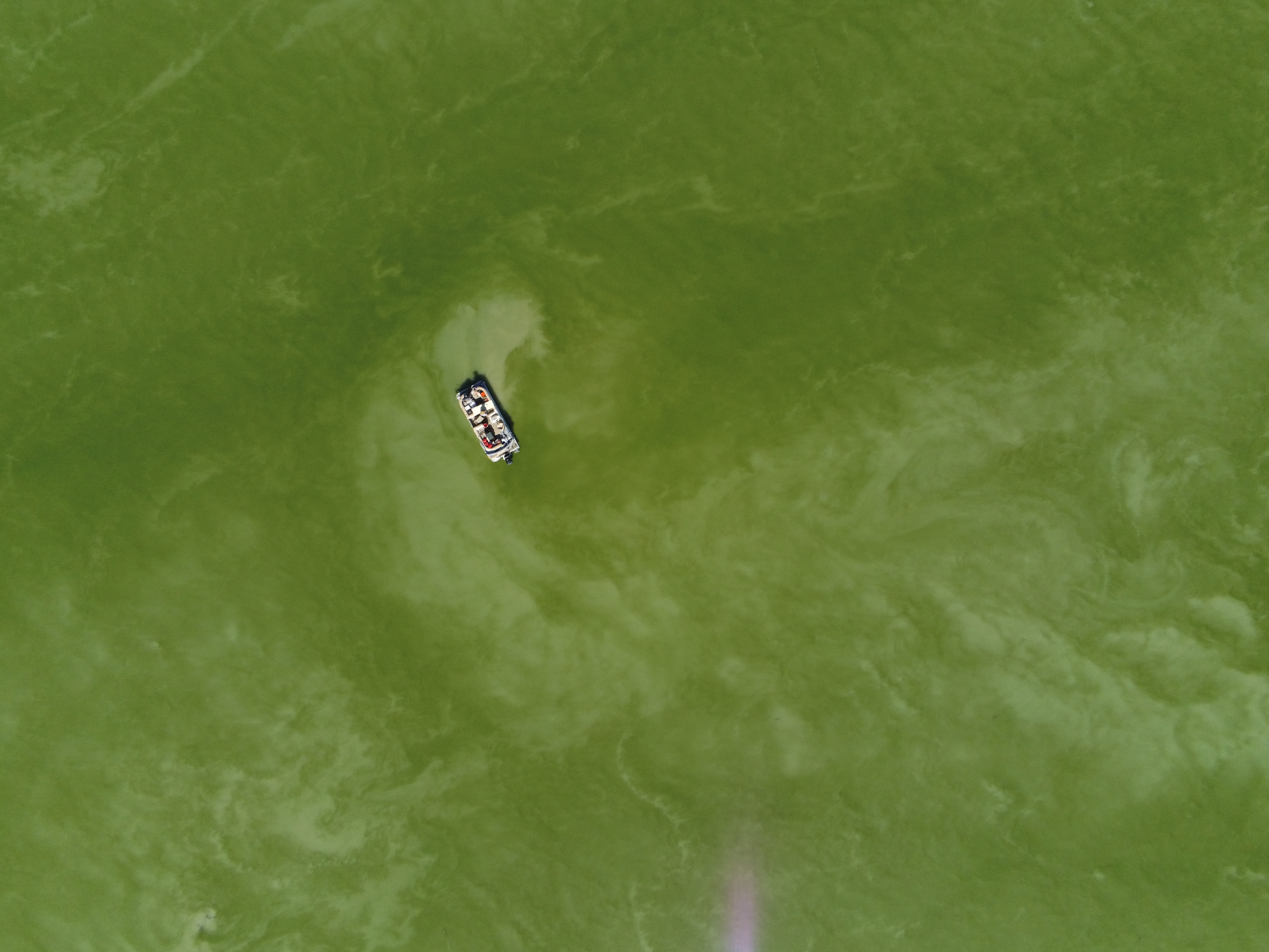
Over the past several years health concerns have been raised over harmful algal blooms (HABs) in the lake with UL beach closures due to HABs every summer since 2016.
The relative impotance of light and nutrient limitation on algal growh in UL is not sufficiently understood to support management decisions. Some researchers hypothesize that algal growth is mostly nutrient limited, while others maintain that UL is mostly light limited. If algal growth in UL is nutrient-limited, then reducing nutrient inflows would have limited impacts on algal blooms.
The purpose of this research is to better understand the relationship between light limitation and algal growth on Utah Lake.
Methods
To determine whether UL is light limited we will collect several sets of data pertaining to light and turbidity throughout the summer of 2023. We will collect photosynthetically available radiation (PAR) measurements, secchi disk readings, turbidity probe measurements, and chlorophyll-a probe measurements on a biweekly basis for 2-to-4-week intervals in several locations throughout UL.
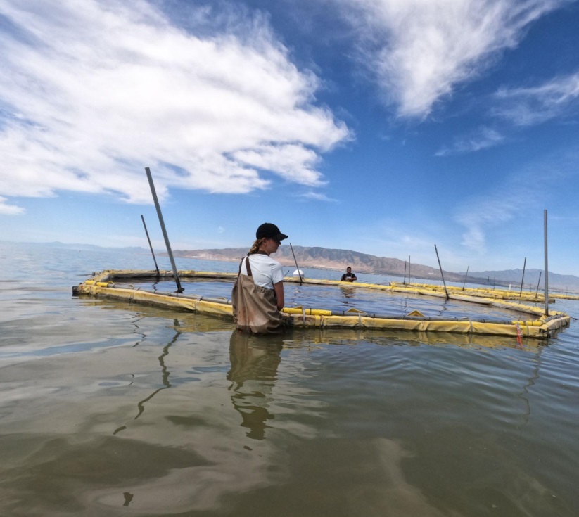
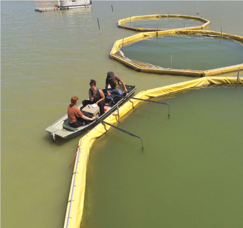
We are designing an algae incubator to better quantify the relationship between algae growth and depth in the water column in UL. We will suspend incubators from the water surface to the lakebed in increments of 0.7 meters then to measure algae growth at each depth. Once algae incubators are deployed, we will periodically extract 60mL sample from the incubators and perform chlorophyll-a and nutrient analysis on the samples. We will use chlorophyll-a as an index to algae mass. When the incubators are deployed, each cell will be filled with lake water from the surface of the lake to provide the initial algae populations.
We will collect and analyze extractions biweekly for the 2-to-4-week incubation period. We will use secchi disk readings, PAR meter measurements, and a multiparameter YSI sonde with turbidity and chlorophyll-a sensors to measure turbidity, light attenuation, and chlorophyll-a concentrations right in the water column near the incubators. At the end of the 2-to-4-week incubation period, we will remove the algae incubator from the lake and measure the total algae growth within each incubator.
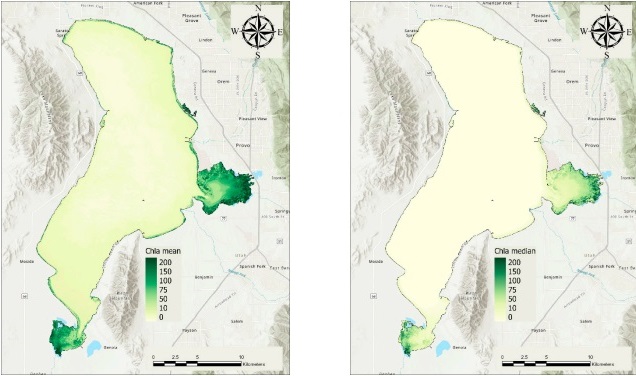
We will deploy the algae incubators in areas with a history of HABs to ensure that sufficient algal growth is detected within the incubators. Remote sensing analyses on UL chlorophyll-a concentrations have indicated that over the span of 40 years mean chlorophyll-a concentrations are most significant in Goshen and Provo Bays. We hope to deploy algae incubators in these locations as well as in two to three other locations throughout UL [1].
The below left figure indicates the mean average and the below right figure shows median average chlorophyll-a concentrations over a 40-year study period. Goshen Bay, Provo Bay, and the shorelines have the highest chl-a concentrations in UL. As such, these would be interesting places to deploy the algae incubators.
Algae Incubator Design
The algae incubator consists of a series of transparent cylindrical containers suspended on a 45-degree-angle from the water surface to the lakebed in a rope-ladder like manner. Each cylindrical container will be placed at incremental depths of 0.7 meters, with sufficient cylinders to span the water column. The 45-degree-angle decreasing the amount of shadow cast by the higher incubators on the lower cylinders and means that light attenuation measured at each incubator is only impacted by the turbidity of the water above it.
The incubator cylinders are capped with a #100 sieve mesh to allow water and nutrients to flow through the incubators. The algae are open to the water but closed off from predators like zooplankton which are too large to pass through the mesh. This allows algae growth to mostly be influenced by available nutrients and sunlight.
The algae incubator has a floatation device at the top to ensure that the depths of the consecutive cylindrical incubators are always at the same depth relative to the surface of the water. We will anchor the flotation device and the bottom of the incubator to the lakebed to prevent the incubators from floating away and to maintain the 45-degree angle.
Each cylinder contains a nozzle to allow for sampling throughout the 2-to-4-week incubation period with minimal disturbance to the cylinder contents. We drilled a hole into the incubator a hole just big enough to insert each nozzle, then caulked each nozzle with silicon around the nozzle and incubator intersection to seal the connection. We connected tubing to each nozzle with sufficient length to reach the floats to aid sampling.
.JPG)
.JPG)
Environmental Measurements
We will take Secchi disk and YSI water sonde measurements in addition to the PAR and algae incubator measurements. We will follow the USGS guidelines for sampling for Secchi measurements. Secchi measurements provide data on the turbidity of Utah Lake and can be used to estimate the depth of the photic zone. One standard empirical model estimates the photic zone depth as 2.5 times the secchi disk measurement.
We will use YSI water sondes to measure vertical profiles of the turbidity, depth, and chlorophyll-a concentrations throughout the study. We will collect the sonde measurements just outside the deployed algae incubators coincident with PAR meter measurements. We will calibrate the sondes weekly to ensure that accurate data are being collected. These data provide more detail on the light attenuation of the lake and could be used to further investigate the data if there are any interesting trends or instances found.
PAR Meter
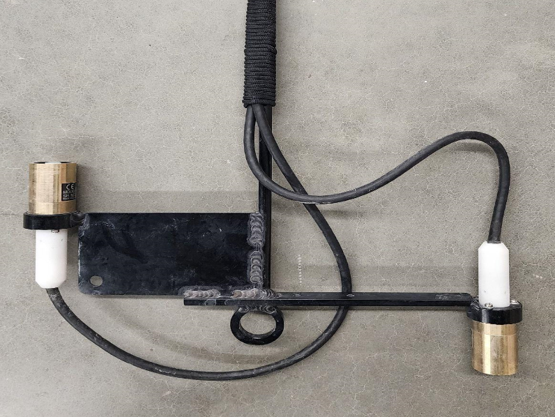
PAR meters measure light penetration, or the amount of light that disperses through the water column. From this we can compute the attenuation of sunlight incident on the water surface to a given depth. The PAR meter for this study consists of two sensors attached to a lowering frame. One sensor points to the water surface and measures downwelling radiation, and the other points to the lakebed and measures upwelling radiation. The downwelling sensor measures the light in the water column that permeates from the water surface whereas the upwelling sensor measures the light that “bounces” back up. The two measurements quantify the amount of PAR available for growth.
Because of the extreme turbidity of UL, we expect upwelling radiation to be minimal as the only source will be from suspended sediments. We believe that the downwelling PAR meter measurements will provide the most insight into the light attenuation of the water column. We want to quantify how the surface light permeates through the water column and affects algal growth. Upwelling radiation can also contribute to growth, but we expect this contribution to be minimal in UL. This phenomenon, limited upwelling, can be seen in the preliminary results section of this page.
The preliminary method we used to measure the light attenuation included slowly lowering the PAR meter and attached depth sensor to the lakebed. Once the sensors reached the furthest depth, the sensors, we slowly brought them back up. We used the time stamps to determine the depths for the PAR readings. This provided data validation with two sets of light attenuation data: when the sensors were lowered and when they were brought back up. As shown in the data, measurements at any given depth were consistent.
Results
During the summer of 2022, we used a LiCOR LI-192 underwater quantum sensor PAR meter to measure the light attenuation in UL. Preliminary results indicate that the photic zone, which is defined as the depth at which only 1% of the surface light is available, was around 0.75 m (2.5 feet). We collected these data on July 11th, 2022, in the north section of UL where the total lake depth was about 1 m (3.28 ft).
The left figure below shows the relationship between depth and light attenuation in the water column for both downwelling and upwelling. Upwelling is consistently lower than the downwelling, this intuitive because light does not reach the bottom of the lake and is only reflected by suspended solids in the water column.
The right figure depicts the downwelling light depreciation in the UL water column and where 50%, 70%, 90%, and 99% of the surface light is lost in the water column. The summary table provides details on the depths at which these respective percent light loss occurred.
| Percent of Surface Light Lost | Depth |
|---|---|
| 50% | 0.271 m (0.89 ft) |
| 70% | 0.27 m (0.89 ft) |
| 90% | 0.335 m (1.1 ft) |
| 99% | 0.764 m (2.5 ft) |
Literature states that the light attenuation coefficient, which is the ratio of the photic zone depth to the mixed layer depth, can be used to indicate light limitation. Due to the shallow nature of UL, we assume that the entire depth of the lake is well mixed. In the area we measured these data, the depth was 1 m, which gives an attenuation coefficient is 0.764. When this ratio is below 1 it is thought that the water body is light limited [2].
.JPG)
References
[1] Tanner, K. B., Cardall, A. C., & Williams, G. P. (2022). A Spatial Long-Term Trend Analysis of Estimated Chlorophyll-a Concentrations in Utah Lake Using Earth Observation Data. Remote Sensing, 14(15), 3664.
[2] Kelble, C. R., Ortner, P. B., Hitchcock, G. L., & Boyer, J. N. (2005). Attenuation of photosynthetically available radiation (PAR) in Florida Bay: Potential for light limitation of primary producers. Estuaries, 28(4), 560-571.
Return to Experiments Main Page